Towns, Cities, Landscapes
One of the most impressive things about large space scanning is how good they look in 3D and being able to fly through them with cinematic camera movements later.
An interesting fact of 3D scanning is that as long as people and traffic are moving, as you scan, they don’t show up in the final results, magic eh?
Drone Scans
With the right flight paths, it’s possible to 3D scan entire towns, landscapes and cities with small (249g) drones. I’ve been piloting drones for around 5 years now and hold the correct certification to fly safely. There are terrific possibilities for real estate and heritage in this type of fun work.
Professional LiDAR
Another way of collecting data for large area scans is with a dedicated professional LiDAR scanner. I own one of these and it allows me to capture a range of 460 feet (140m) in all directions at the same time as it captures 360 photo with excellent spatial fidelity.
The 3D scans from these are best viewed in virtual reality to understand how detailed and immersive they are and they don’t take long to capture. Processing on the other hand, can take a while depending on the size of the area being scanned. Powerful graphics processing is used for rendering these large areas as well as post production touches that can add a day or more work on top of the fast capture.
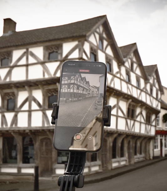
Phones can also capture fairly large areas and buildings efficiently using mobile apps and smartphone processing.
The nice thing is that scenes like this one can instantly be shared on map systems in VR in less than an hour from capture.
